117 BALDPATE HILL RD
Owner Information
CROOPNICK STEVEN R
117 BALDPATE HILL RD
NEWTON, MA 02459


Property Details
117 BALDPATE HILL RD is classified as a Single Family Residential (Tudor).
The primary structure on this property was built in 1935. There are 6,030ft2 of built area within this property. There is 3,824ft2 of residential/living space within this property. This property is listed as having 13 rooms.
117 BALDPATE HILL RD is valued at $2,462,400. The land is valued at $1,391,800 and the structures are valued at $1,070,600.
This property is in Zone SR1. Confirm with local Zoning Board authorities to ensure there are no overlays or other easements on this property.
The most recent deed for 117 BALDPATE HILL RD is recorded at the local registrar in Book 1385, Page 76. 117 BALDPATE HILL RD was last sold on Monday, June 14, 2010 for $1.
Assessment data from fiscal year 2022.
Flood Data
According to the FEMA National Flood Hazard Layer, this property does not appear to be in a flood zone. It may also be in an area not yet reviewed. Nonetheless, confirm this information prior to taking any action.
To view the flood hazards around this property, create a FEMA "Firmette" Map of the area around 117 BALDPATE HILL RD.
Broadband Internet Providers
| Provider | Type | Bandwidth (mbps) | |
|---|---|---|---|
| Verizon New England Inc. | DSL | 5 | 0 |
| VSAT Systems, LLC. | Satellite | 2 | 1 |
| HughesNet | Satellite | 25 | 3 |
| RCN | Cable | 500 | 20 |
| Comcast | Cable | 1000 | 35 |
| GCI Communication Corp. | Satellite | 0 | 0 |
| RCN | Cable | 1000 | 20 |
| Verizon New England Inc. | Fiber | 940 | 880 |
| Viasat Inc | Satellite | 100 | 3 |
Broadband service provider data from December 2020.
Adjacent Properties
- 123 BALDPATE HILL RD
Single Family Residential owned by MOIN POOR FARZANEH - 43 JACOBS TER
Single Family Residential owned by LEVSKY REALTY LLC - 105 BALDPATE HILL RD
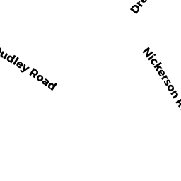
Single Family Residential owned by LIPOF JANICE P - 54 DRUMLIN RD
Single Family Residential owned by BAI WENTAO - 60 DRUMLIN RD
Single Family Residential owned by ZAGER NOAH I & ANN M - 72 DRUMLIN RD
Single Family Residential owned by ZHANG DONGQUAN